Since the first seeds of civilization were planted, access to arable land has been central to human life. Yet even today, 12,000 years later, ownership of rich farm soil has largely been denied to one gender. Women, who make up half of the global adult population and 43 percent of the agricultural workforce, account for less than 15 percent of farmland owners. Nearly 40 percent of the world’s economies still limit women’s property rights, according to the World Bank. In the remaining 60 percent, male-centric cultural norms and legal inefficiencies still hinder women’s rights.
Ensuring women have the right to own land could lift millions of people out of hunger, reduce rural poverty, and improve sustainable natural resource management, according to studies from the United Nations (UN), World Bank, women’s rights nonprofit Landesa, and others. Such sources also agree that achieving global gender equity will start with local efforts—often by putting more information in the hands of women.
“It’s about data empowerment,” said Amy Coughenour Betancourt, CEO of Cadasta, a global nonprofit that connects communities with technologies for recording land and resource rights. “We approach it as enabling local stakeholders to document, secure, and manage their land rights and helping communities understand and use the data that’s collected.”

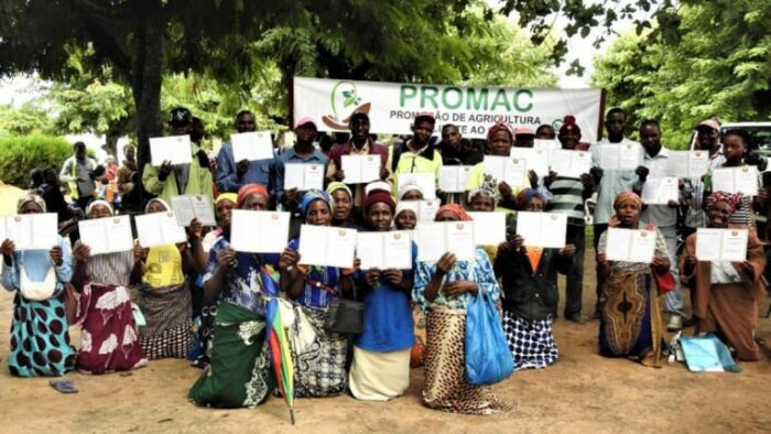
Giving women the choice to take ownership of their land starts with building a better understanding of their legal rights, and that begins with capturing digital records. Better access to maps and property data can also simplify proof of ownership, which can be expensive and time-consuming to obtain, particularly in rural communities. In Mozambique, for example, Cadasta worked with local leaders and the National Cooperative Business Association CLUSA International (NCBA CLUSA) to make it easier for local farmers to get a certificate of landownership. Digital maps created with GIS technology eliminated several surveying steps, lowering time and costs from upwards of a year and US$400 in some cases to as little as three months and $30.
“Mozambique is a really good example of how the technology facilitates these processes,” Coughenour Betancourt said. “And the efforts in Mozambique emphasize women-led farms—women are given priority, and if the woman is married, she’s included on the certificate along with her husband.”